


ArcGIS Field Maps Beta
Description of ArcGIS Field Maps Beta
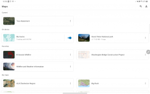
ArcGIS Field Maps is Esri’s premier maps application designed for users who need to explore and interact with maps created in ArcGIS. This application, available for the Android platform, allows users to download maps, collect and update data, and access location-aware features all in one tool. It is particularly valuable for professionals who require reliable and efficient means to manage geographic information in the field.
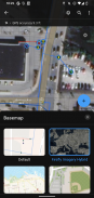
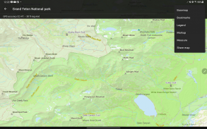
The app supports high-quality, cartographic maps that are generated using ArcGIS. Users can seamlessly access these maps on their devices, and the ability to download them ensures that they can work offline. This feature is essential for users who may operate in areas with limited or no internet connectivity, allowing them to continue their work without interruption.
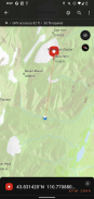
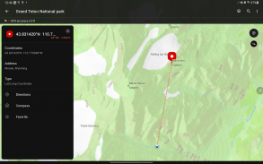
Searching for data, coordinates, or places is straightforward within ArcGIS Field Maps. The application provides a user-friendly interface that simplifies the process of locating specific information on the map. Users can easily navigate through various datasets, making it easier to find relevant geographical data.
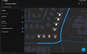
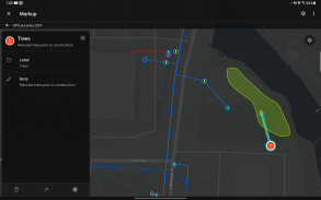
Marking up maps is another feature that enhances the usability of ArcGIS Field Maps. Users can annotate maps for personal reference or share these customizations with colleagues. This capability improves collaboration among teams, as users can highlight important areas or add notes directly on the map.
Professional-grade GPS receivers can be integrated with the app, enabling accurate data collection and updates. Users can take advantage of this feature to enhance the precision of their geographical data, which is crucial for tasks requiring high levels of accuracy. The app continuously tracks location data, even when running in the background, ensuring that users do not miss any critical information while working.
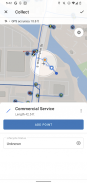
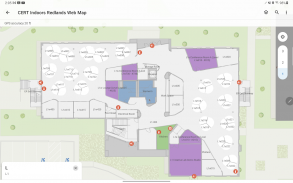
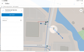
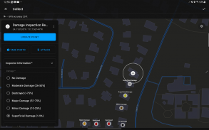
The data collection aspect of ArcGIS Field Maps is facilitated through easy-to-use, map-driven smart forms. These forms allow users to input data efficiently, reducing time spent on data entry. The intuitive design of these forms ensures that users can quickly adapt to the application, regardless of their experience level.
Additionally, users have the option to attach photos and videos to their GIS data. This feature allows for richer data collection, as visual elements can provide context and support for the information being recorded. By incorporating multimedia, users can create more comprehensive datasets that are beneficial for analysis and reporting.
ArcGIS Field Maps emphasizes data management capabilities. Users can not only collect new data but also update existing datasets directly through the app. This functionality is vital for maintaining the accuracy and reliability of geographical information, as it enables real-time updates and corrections.
Moreover, the application offers a robust search function that allows users to find specific locations or data points quickly. By entering keywords or coordinates, users can rapidly navigate to the desired information, streamlining their workflow.
The app is designed to support various user needs, from simple map viewing to complex data collection tasks. Its versatility makes it suitable for a wide range of applications, including environmental monitoring, urban planning, and field research. Professionals in these fields can benefit from the comprehensive features that facilitate effective data management and analysis.
Users can take advantage of the offline capabilities of ArcGIS Field Maps, which allows them to download essential maps and work without internet access. This feature is particularly important for those working in remote areas, ensuring that they have the necessary tools at their disposal regardless of connectivity issues.
In terms of usability, the interface of ArcGIS Field Maps is designed to be intuitive and user-friendly. Users can easily navigate through the various functions without extensive training or prior experience. This accessibility makes it a practical choice for organizations looking to implement a mapping solution for their teams.
The ability to integrate with other Esri products enhances the functionality of ArcGIS Field Maps. Users can leverage existing datasets and tools within the Esri ecosystem, creating a cohesive workflow that maximizes productivity and efficiency.
Professionals utilizing ArcGIS Field Maps can experience significant improvements in their data collection processes. The combination of easy navigation, accurate GPS capabilities, and multimedia attachments facilitates comprehensive data gathering and management.
With its focus on enhancing user experience and providing essential mapping tools, ArcGIS Field Maps stands out as an effective solution for those needing to manage geographical information. The app's diverse features cater to various user requirements, ensuring that it remains a valuable resource for professionals across different sectors.
Users interested in optimizing their data collection and mapping capabilities should consider the advantages offered by ArcGIS Field Maps. The combination of offline access, intuitive data entry, and multimedia integration makes it a powerful tool for effectively managing geographic information in a variety of contexts.
ArcGIS Field Maps Beta - Version 24.3.0
(19-11-2024)ArcGIS Field Maps Beta - APK Information
APK Version: 24.3.0Package: com.esri.fieldmaps.betaLatest Version of ArcGIS Field Maps Beta
Other versions


Apps in the same category

You may also like...


